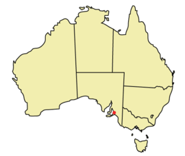
Template:Infobox Australian place/Examples
Appearance
These are some examples of Infobox Australian place.
Region
[change source]| Yorke Peninsula South Australia | |
|---|---|
 The town of Ardrossan, located in Yorke Peninsula | |
| Population | ~ 25,000 |
| Established | 1840s |
| LGA(s) |
|
| State electorate(s) | Goyder |
| Federal division(s) | Grey |
| Website | Yorke Peninsula |
{{Infobox Australian Place
| type     = region
| name     = Yorke Peninsula
| state    = sa
| image    = Ardrossan.jpg
| caption  = The town of Ardrossan, located in Yorke Peninsula
| pop      = ~ 25,000
| est      = 1840s
| url      = http://www.yorkepeninsula.com.au/
| lga      = District Council of Yorke Peninsula
| lga2     = District Council of the Copper Coast
| lga3     = District Council of Barunga West
| stategov = [[Electoral district of Goyder|Goyder]]
| fedgov   = [[Division of Grey|Grey]]
}}
Local Government Area
[change source]| Adelaide Hills Council South Australia | |
|---|---|
 | |
| Population | 36,629 |
| • Density | 46/km2 (120/sq mi) |
| Established | 1997 |
| Area | 795.08 km2 (307.0 sq mi) |
| Mayor | Bill Cooksley |
| Council seat | Woodside |
| Region | Adelaide Hills, Metropolitan Adelaide |
| State electorate(s) | Morialta, Kavel, Schubert |
| Federal division(s) | Mayo, Sturt, Wakefield |
| Website | Adelaide Hills Council |
{{Infobox Australian Place
| name      = Adelaide Hills Council
| type      = lga
| state     = sa
| image     = Adelaide-LGA-Adelaide Hills-MJC.png
| pop       = 36,629
| density   = 46
| area      = 795.08
| est       = 1997
| mayor     = Bill Cooksley
| seat      = [[Woodside, South Australia|Woodside]]
| logo      = NonFreeImageRemoved.svg
| url       = http://www.ahc.sa.gov.au
| fedgov    = [[Division of Mayo|Mayo]], [[Division of Sturt|Sturt]], [[Division of Wakefield|Wakefield]]
| stategov  = [[Electoral district of Morialta|Morialta]], [[Electoral district of Kavel|Kavel]], [[Electoral district of Schubert|Schubert]]
| region    = [[Adelaide Hills]], [[Adelaide|Metropolitan Adelaide]]
}}
City
[change source]| Adelaide South Australia | |
|---|---|
 | |
| Population | 1,124,315 (5th) |
| • Density | 615/km2 (1,590/sq mi) |
| Area | 1,826.9 km2 (705.4 sq mi) |
| Time zone | ACST (UTC+9:30) |
| • Summer (DST) | ACDT (UTC+10:30) |
{{Infobox Australian Place
| name     = Adelaide
| state    = sa
| type     = city
| image    = Adelaide locator-MJC.png
| area     = 1826.9
| timezone = [[UTC9:30|ACST]]
| utc      = +9:30
| timezone-dst= [[UTC10:30|ACDT]]
| utc-dst  = +10:30
| pop      = 1,124,315
| poprank  = 5th
| density  = 615
}}
Suburb
[change source]| Elizabeth Adelaide, South Australia | |||||||||||||||
|---|---|---|---|---|---|---|---|---|---|---|---|---|---|---|---|
| Population | 811 (2001)[1] | ||||||||||||||
| Established | 1955 | ||||||||||||||
| Postcode(s) | 5112 | ||||||||||||||
| LGA(s) | City of Playford | ||||||||||||||
| |||||||||||||||
{{Infobox Australian Place
| name     = Elizabeth
| state    = sa
| type     = suburb
| lga      = City of Playford
| city     = Adelaide
| est      = 1955
| postcode = 5112
| pop      = 811 (2001)<ref>2001 Census, Australian Bureau of Statistics</ref>
| propval  = $160,000
| near-nw  = [[Elizabeth West, South Australia|Elizabeth West]]
| near-n   = [[Elizabeth North, South Australia|Elizabeth North]]
| near-ne  = [[Elizabeth Park, South Australia|Elizabeth Park]]
| near-w   = [[Edinburgh, South Australia|Edinburgh]]
| near-e   = [[Elizabeth East, South Australia|Elizabeth East]]
| near-sw  = [[Elizabeth South, South Australia|Elizabeth South]]
| near-s   = [[Elizabeth Vale, South Australia|Elizabeth Vale]]
| near-se  = [[Hillbank, South Australia|Hillbank]]
}}
Town
[change source]| Mount Barker South Australia | |||||||||||||||
|---|---|---|---|---|---|---|---|---|---|---|---|---|---|---|---|
 The southern entrance to the Mount Barker Central mall. | |||||||||||||||
| Population | 11,540 (2006 Census) | ||||||||||||||
| Established | 1834 | ||||||||||||||
| Postcode(s) | 5251 | ||||||||||||||
| Elevation | 360 m (1,181 ft) | ||||||||||||||
| Location | 40 km (25 mi) from Adelaide | ||||||||||||||
| LGA(s) | Mount Barker | ||||||||||||||
| State electorate(s) | Kavel, Heysen | ||||||||||||||
| Federal division(s) | Mayo | ||||||||||||||
| |||||||||||||||
| |||||||||||||||
{{Infobox Australian Place | type = town
| name = Mount Barker
| state = sa
| image = Mtb central 2.JPG
| caption = The southern entrance to the Mount Barker Central mall.
| lga = [[District Council of Mount Barker|Mount Barker]]
| postcode = 5251
| pop = 11,540 <small>''(2006 Census)''</small>
| propval = $285,000<ref>[http://www.domain.com.au/Public/SuburbProfile.aspx?suburb=Mount%20Barker&postcode=5251 domain.com.au] "Mount Barker suburb profile"</ref>
| est = 1834
| elevation = 360
| maxtemp = 19.9
| mintemp = 8.0
| rainfall = 764.4
| stategov = [[Electoral district of Kavel|Kavel]], [[Electoral district of Heysen|Heysen]]
| fedgov = [[Division of Mayo|Mayo]]
| dist1 = 40
| location1 = [[Adelaide]]
| near-nw  = [[Hahndorf, South Australia|Hahndorf]]
| near-n   = [[Littlehampton, South Australia|Littlehampton]]
| near-ne  = [[Nairne, South Australia|Nairne]]
| near-w   = [[Echunga, South Australia|Echunga]]
| near-e   = [[Callington, South Australia|Callington]]
| near-sw  = [[Macclesfield, South Australia|Macclesfield]]
| near-s   = [[Strathalbyn, South Australia|Strathalbyn]]
| near-se  = [[Langhorne Creek, South Australia|Langhorne Creek]]
| latd     = 35
| latm     = 04
| longd    = 138
| longm    = 51
}}
References
- ↑ 2001 Census, Australian Bureau of Statistics
- ↑ domain.com.au "Mount Barker suburb profile"
