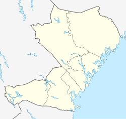
Timrå
Appearance
Timrå | |
|---|---|
 Timrå montage, Top:Panorama view of downtown Timrå, from Alnön area, 2nd left:A native house and museum in Merlo Slotto, 2nd right:A headquarters in Östrands pulp (Östrands massafabrik), 3rd left:Sydkraft Arena (E.ON Arena), 3rd right:Köpmansgatan Square, Bottom:Aerial view over Sörberge with Indalsälven left and Fairhaven in the upper right corner | |
| Coordinates: 62°29′13″N 17°19′33″E / 62.48694°N 17.32583°E | |
| Country | Sweden |
| Province | Medelpad |
| County | Västernorrland County |
| Municipality | Timrå Municipality |
| Area | |
| • City | 12.03 km2 (4.64 sq mi) |
| • Metro | 787.98 km2 (304.24 sq mi) |
| Elevation | 19 m (62 ft) |
| Population (31 December 2010)[1] | |
| • City | 10,443 |
| • Density | 868/km2 (2,250/sq mi) |
| • Metro | 17,844 |
| Time zone | UTC+1 (CET) |
| • Summer (DST) | UTC+2 (CEST) |
| Postal code | 860 xx |
| Area code | (+46) 60 |
| Website | www |
Timrå is a locality, and the seat of Timrå Municipality, in the county of Västernorrland in northern Sweden.
It is the home of ice hockey club Timrå IK.
References
[change | change source]- ↑ 1.0 1.1 "Tätorternas landareal, folkmängd och invånare per km2 2005 och 2010" (in Swedish). Statistics Sweden. 14 December 2011. Archived from the original on 27 January 2012. Retrieved 10 January 2012.
Other websites
[change | change source]![]() Media related to Timrå at Wikimedia Commons
Media related to Timrå at Wikimedia Commons


