Uruguay
Oriental Republic of Uruguay
| |
|---|---|
| Motto: "Libertad o Muerte" (Spanish) "Freedom or Death" | |
| Anthem: Himno Nacional de Uruguay National Anthem of Uruguay | |
 | |
| Capital and largest city | Montevideo |
| Official language |
|
| Ethnic groups ([1]) |
|
| Demonym(s) | Uruguayan |
| Government | Unitary presidential constitutional republic |
| Yamandú Orsi | |
| Carolina Cosse | |
| Legislature | General Assembly |
| Chamber of Senators | |
| Chamber of Deputies | |
| Independence from the Empire of Brazil | |
• Declaration | 25 August 1825 |
| 28 August 1828 | |
• Constitution | 18 July 1830 |
| Area | |
• Total | 176,215 km2 (68,037 sq mi) (91st) |
• Water (%) | 1.5 |
| Population | |
• 2011 estimate | 3,318,535[1] (133rd) |
• 2011 census | 3,286,314[2] |
• Density | 18.65/km2 (48.3/sq mi) (196th) |
| GDP (PPP) | 2013 estimate |
• Total | $56.338 billion[3] |
• Per capita | $16,607[3] |
| GDP (nominal) | 2013 estimate |
• Total | $55.412 billion[3] |
• Per capita | $16,334[3] |
| Gini (2010) | 45.3[4] medium |
| HDI (2013) | high · 51st |
| Currency | Uruguayan peso (UYU) |
| Time zone | UTC−3 (UYT) |
• Summer (DST) | UTC−2 (UYST) |
| Driving side | right |
| Calling code | +598 |
| ISO 3166 code | UY |
| Internet TLD | .uy |

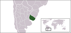
Uruguay (officially named Oriental Republic of Uruguay) is a country in South America. The language spoken there is Spanish. Its capital and largest city is Montevideo. Uruguay is bordered by two large neighbors, Brazil and Argentina. The only country in South America that is smaller than Uruguay is Suriname. The land is mostly flat, and there are many farms in the countryside.
The area around Uruguay was fought over by the Portuguese and Spanish Empires in the 18th century. In the 1810s it was the center of the Banda Oriental, a Federal League of states in the Río de la Plata region. Argentina and Brazil took the majority in wars, leaving Uruguay as independent.
History
[change | change source]Before Europeans came to the land, no more than 10 thousand native people lived here. Spanish explorer Juan Díaz de Solís first explored the land in 1516.[6]
Departments
[change | change source]
Uruguay is divided into 19 different Departments.
| Department | Capital | Area | Population (2011 census)[7] |
|---|---|---|---|
| Artigas | Artigas | 11,928 km2 (4,605 sq mi) | 73,162 |
| Canelones | Canelones | 4,536 km2 (1,751 sq mi) | 518,154 |
| Cerro Largo | Melo | 13,648 km2 (5,270 sq mi) | 84,555 |
| Colonia | Colonia del Sacramento | 6,106 km2 (2,358 sq mi) | 122,863 |
| Durazno | Durazno | 11,643 km2 (4,495 sq mi) | 57,082 |
| Flores | Trinidad | 5,144 km2 (1,986 sq mi) | 25,033 |
| Florida | Florida | 10,417 km2 (4,022 sq mi) | 67,093 |
| Lavalleja | Minas | 10,016 km2 (3,867 sq mi) | 58,843 |
| Maldonado | Maldonado | 4,793 km2 (1,851 sq mi) | 161,571 |
| Montevideo | Montevideo | 530 km2 (200 sq mi) | 1,292,347 |
| Paysandú | Paysandú | 13,922 km2 (5,375 sq mi) | 113,112 |
| Río Negro | Fray Bentos | 9,282 km2 (3,584 sq mi) | 54,434 |
| Rivera | Rivera | 9,370 km2 (3,620 sq mi) | 103,447 |
| Rocha | Rocha | 10,551 km2 (4,074 sq mi) | 66,955 |
| Salto | Salto | 14,163 km2 (5,468 sq mi) | 124,683 |
| San José | San José de Mayo | 4,992 km2 (1,927 sq mi) | 108,025 |
| Soriano | Mercedes | 9,008 km2 (3,478 sq mi) | 82,108 |
| Tacuarembó | Tacuarembó | 15,438 km2 (5,961 sq mi) | 89,993 |
| Treinta y Tres | Treinta y Tres | 9,529 km2 (3,679 sq mi) | 48,066 |
| Total¹ | — | 175,016 km2 (67,574 sq mi) | 3,251,526 |
- ¹Doesn't include the artificial lakes on the Rio Negro (1,199 km²).Archived 2013-11-13 at the Wayback Machine
Geography
[change | change source]The highest point in the country is the Cerro Catedral whose peak reaches to 514 metres (1,686 ft).
Uruguay has 660 km of coastline.[1]
There are nine National Parks in Uruguay. Five in the wetland areas of the east, three in the central hill country and one in the west along the Rio Uruguay.
- 2nd smallest country on continent
- South America
- Sandy beaches near Montevideo
- In the north, a series of low mountains run north into the highlands of Brazil
- 176,220 square kilometers
- Mostly hills
- A lot of water rich lands
- Near Brazil and Argentina
Economy
[change | change source]Agriculture
[change | change source]According to FAOSTAT, Uruguay is one of world's largest producers of: soybeans (9th); greasy wool (12th); horse meat (14th); beeswax (14th); quinces (17th); natural honey (19th); cattle meat (20th).[8] On December 20, 2013, Uruguay was the first country in the world to legalize the cultivation, sale, and use of cannabis.[9]
Demographics
[change | change source]| Colour/Race (self-reported, 2008)[10] | |
|---|---|
| White | 95.4% |
| Black/African | 3.4% |
| Indigenous | 1.1% |
| Asian/Amarillo | 0.1% |
Uruguayans are mostly of European origin. 88%, or 88 of 100 people, are from European descent.[1]
Sports
[change | change source]
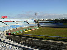
Football is the most popular sport in Uruguay. The Uruguay national football team has won the FIFA World Cup on two occasions.
References
[change | change source]- ↑ 1.0 1.1 1.2 1.3 Central Intelligence Agency. "Uruguay". The World Factbook. Archived from the original on 12 June 2007. Retrieved 5 January 2010.
- ↑ Resultados del Censo de Población 2011: población, crecimiento y estructura por sexo y edad Archived 2014-02-09 at the Wayback Machine ine.gub.uy
- ↑ 3.0 3.1 3.2 3.3 "Uruguay". International Monetary Fund. Retrieved 4 January 2012.
- ↑ "Gini Index". World Bank. Retrieved 14 April 2012.
- ↑ "Human Development Report 2013" (PDF). United Nations Development Programme. 14 March 2013. Archived from the original (PDF) on 8 July 2014. Retrieved 14 March 2013.
- ↑ "Uruguay - Sports and recreation". Encyclopedia Britannica. Retrieved 2021-05-07.
- ↑ "Censos 2011 - Instituto Nacional de Estadistica". Instituto Nacional de Estadística. Archived from the original on 12 January 2012. Retrieved 13 January 2012.
- ↑ "FAOSTAT 2008 by Production". faostat.fao.org. Archived from the original on 2019-01-06. Retrieved 2008-06-06.
- ↑ "Uruguay becomes first country to legalize marijuana trade". NBCNews.com. Retrieved December 11, 2013.
- ↑ "Encuesta Continua de Hogares 2008 – Ascendencia principal declarada". Instituto Nacional de Estadística. Archived from the original on 14 November 2010. Retrieved 2 December 2010.
Official Websites
[change | change source]- Uruguay Official Portal Archived 2011-08-09 at the Wayback Machine
- Uruguay Official Presidency Website Archived 2011-02-24 at the Wayback Machine


