West Tennessee
Appearance
West Tennessee | |
|---|---|
|
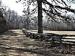
Clockwise, from top left: The Memphis Pyramid, Graceland, Beale Street, Pinson Mounds, Shiloh National Military Park, Reelfoot Lake | |
| Nickname(s): West TN, West Tenn. | |
 The counties of Tennessee highlighted in red that are designated part of West Tennessee. | |
| Country | |
| State | |
| Largest city | Memphis |
| Area | |
| • Land | 27,600 km2 (10,650 sq mi) |
| Population (2020) | 1,557,649 |
| • Density | 56.47/km2 (146.26/sq mi) |
| Demonym | West Tennessean |
West Tennessee is one of the three Grand Divisions of the U.S. state of Tennessee. It is mostly the western part of the state.[1] The area includes 21 counties between the Tennessee and Mississippi rivers.[2] Its geography consists primarily of flat lands with rich soil and vast floodplain areas of the Mississippi River.[1][3] Of the three regions, West Tennessee is the most sharply defined geographically, and is the lowest-lying.[4] It is both the least populous and smallest by land area, of the three Grand Divisions. Its biggest city is Memphis, the state's second most populated city.
Counties
[change | change source]There are 21 counties in West Tennessee.
References
[change | change source]- ↑ 1.0 1.1 "Tennessee | Capital, Map, Population, History, & Facts". Encyclopedia Britannica. Retrieved 2019-10-15.
- ↑ "Tennessee Blue Book 2015-2016" (PDF). sos.tn.gov. Nashville: Tennessee Secretary of State. 2015. p. 639. Retrieved June 5, 2021.
- ↑ "West Region". www.tn.gov. Retrieved 2019-10-15.
- ↑ "Tennessee Culture - Tennessee History - Grand Divisions - THS". Tennessee Historical Society. 2017-03-13. Retrieved 2019-10-15.


