Cheshire, Connecticut
Appearance
Cheshire, Connecticut | |
|---|---|
 First Congregational Church of Cheshire | |
| Nickname: The Bedding Plant Capital of Connecticut | |
| Coordinates: 41°30′44″N 72°54′13″W / 41.51222°N 72.90361°W | |
| Country | |
| U.S. state | |
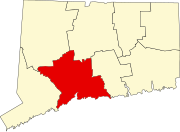
| County | New Haven |
| Region | Naugatuck Valley |
| Settled | 1694 |
| Incorporated | 1780 |
| Named for | Cheshire, England |
| Area | |
| • Total | 33.4 sq mi (86.4 km2) |
| • Land | 33.1 sq mi (85.6 km2) |
| • Water | 0.3 sq mi (0.8 km2) |
| Elevation | 230 ft (70 m) |
| Population (2020)[1] | |
| • Total | 28,733 |
| • Density | 860/sq mi (330/km2) |
| Demonym | Cheshirite |
| Time zone | UTC−5 (EST) |
| • Summer (DST) | UTC−4 (EDT) |
| ZIP code | 06410 |
| Area code(s) | 203/475 |
| FIPS code | 09-14160 |
| GNIS feature ID | 0213406 |
| Website | www |
Chesire is a town in New Haven County, Connecticut. The population was 28,733 in 2020.[1] It is the center of population for the state of Connecticut.[2] In 2009, Chesire was ranked #72 in Money magazine's "100 Best Places to Live".[3] In 2011, Chesire was ranked #73 in Money's "100 Best Places to Live".[4]
References
[change | change source]- ↑ 1.0 1.1 "Census - Geography Profile: Cheshire town, Fairfield County, Connecticut". United States Census Bureau. Retrieved August 6, 2023.
- ↑ "Population and Population Centers by State". United States Census Bureau: 2000 Census. Retrieved August 18, 2007.
- ↑ "Best Places to Live 2009". CNN.
- ↑ "Best Places to Live 2011". CNN.


