Derby, Connecticut
Appearance
Derby, Connecticut | |
|---|---|
| Motto: "Connecticut's Smallest City"[1] | |
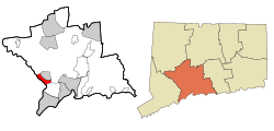
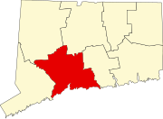
 Derby's location within New Haven County and Connecticut | |
| Coordinates: 41°19′36″N 73°04′56″W / 41.32667°N 73.08222°W | |
| Country | |
| State | |
| County | New Haven |
| Settled | 1642 |
| Named | 1675 |
| Incorporated-town | 1775 |
| Incorporated-city | 1893 |
| Founded by | John Wakeman |
| Named for | Derby, England |
| Area | |
| • Total | 5.41 sq mi (14.00 km2) |
| • Land | 5.06 sq mi (13.09 km2) |
| • Water | 0.35 sq mi (0.91 km2) |
| Highest elevation | 469 ft (142 m) |
| Lowest elevation | 3 ft (1 m) |
| Population | |
| • Total | 12,325 |
| • Rank | 19th (CT) |
| • Density | 2,435.8/sq mi (941.6/km2) |
| Time zone | UTC-5 (Eastern) |
| • Summer (DST) | UTC-4 (Eastern) |
| ZIP code | 06418 |
| Area code(s) | 203/475 |
| FIPS code | 09-19480 |
| GNIS feature ID | 0206671 |
| Major highways | |
| Website | www |
Derby is a city in Connecticut in the United States.
References
[change | change source]- ↑ "City of Derby Connecticut". City of Derby Connecticut. Retrieved September 22, 2012.
- ↑ "2019 U.S. Gazetteer Files". United States Census Bureau. Retrieved July 2, 2020.
- ↑ "QuickFacts: Derby city, Connecticut". U.S. Census Bureau. Retrieved August 3, 2023.


