
Islands of the Philippines

The island groups of the Philippines, are the administrative division of major states comprising the Luzon, Visayas and Mindanao designated as (Luzviminda), feminine name.
Major island states
[change | change source].jpg)
Luzon
[change | change source]The Luzon is the largest island group of the Philippines or also known as North Philippines and there are sub-regions of the island, The North Luzon, Central Luzon (III) and South Luzon, and its largest city is Quezon City, situated ajdacent the capital city in Metro Manila.
Visayas
[change | change source]The Visayas is the central group islands of the Philippines, located geographically in Sulu Sea and Sibuyan Sea. composed of the three regions, the Western Visayas (VI), Central Visayas (VII) and Eastern Visayas (VIII) and the largest city is Cebu City.
Mindanao
[change | change source]Mindanao is the southernmost of island of the Philippines, homeland of the Filipino Christians and Muslims, consisting of six regions, are the Zamboanga Peninsula, Northern Mindanao, Davao Region, Soccsksargen, Caraga and Bangsamoro, the largest city is Davao City.
Gallery
[change | change source]- Largest cities of the Philippines
-
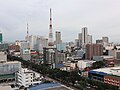 Quezon City, the largest city in Luzon.
 -
 Cebu City, Philippines oldest city in Visayas.
 -
 Davao City, Mindanao's largest city in Mindanao.
.jpg)
.jpg)
.jpg)