Parker, Colorado
Appearance
Parker, Colorado | |
|---|---|
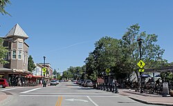
 Mainstreet in downtown Parker | |
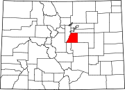
 Location of Parker in Douglas County, Colorado. | |
| Coordinates: 39°31′10″N 104°45′57″W / 39.51944°N 104.76583°W[1] | |
| Country | United States |
| State | Colorado |
| County | Douglas |
| Incorporated | May 1981[2] |
| Government | |
| • Type | Home rule municipality[3] |
| Area | |
| • Total | 22.37 sq mi (57.85 km2) |
| • Land | 22.34 sq mi (57.84 km2) |
| • Water | 0.01 sq mi (0.02 km2) |
| Elevation | 5,869 ft (1,789 m) |
| Population | |
| • Total | 58,512 |
| • Density | 402.7/sq mi (1,043/km2) |
| Time zone | UTC-7 (MST) |
| • Summer (DST) | UTC-6 (MDT) |
| ZIP codes[7] | 80134, 80138 |
| Area code(s) | Both 303 and 720 |
| FIPS code | 08-57630 |
| GNIS feature ID | 0185051 |
| Website | www |
Parker is a town in Douglas County, Colorado.
Sources
[change | change source]- ↑ "US Gazetteer files: 2010, 2000, and 1990". United States Census Bureau. February 12, 2011. Retrieved April 23, 2011.
- ↑ "Colorado Municipal Incorporations". State of Colorado, Department of Personnel & Administration, Colorado State Archives. December 1, 2004. Retrieved September 2, 2007.
- ↑ "Active Colorado Municipalities". State of Colorado, Department of Local Affairs. Archived from the original on February 2, 2007. Retrieved September 1, 2007.
- ↑ "2021 U.S. Gazetteer Files". United States Census Bureau. Retrieved February 9, 2023.
- ↑ "US Board on Geographic Names". United States Geological Survey. October 25, 2007. Retrieved January 31, 2008.
- ↑ "Parker town, Colorado". United States Census Bureau. Retrieved September 13, 2023.
- ↑ "ZIP Code Lookup". United States Postal Service. Archived from the original (JavaScript/HTML) on September 27, 2004. Retrieved December 2, 2007.


