Roseville, California
Appearance
Roseville, California | |
|---|---|
|
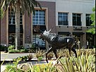
Clockwise: Tower Theatre; St. Clare Church; Carnegie Museum; Fountains at Roseville | |
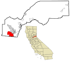
 Location in Placer County and the state of California | |
| Coordinates: 38°45′9″N 121°17′22″W / 38.75250°N 121.28944°W | |
| Country | United States |
| State | California |
| County | Placer |
| Incorporated | April 10, 1909[1] |
| Government | |
| • Type | Council-manager |
| Area | |
| • Total | 44.08 sq mi (114.16 km2) |
| • Land | 44.08 sq mi (114.16 km2) |
| • Water | 0.00 sq mi (0.00 km2) |
| Elevation | 164 ft (50 m) |
| Population | |
| • Total | 147,773 |
| • Rank | 1st in Placer County 39th in California |
| • Density | 3,400/sq mi (1,300/km2) |
| Time zone | UTC−8 (Pacific) |
| • Summer (DST) | UTC−7 (PDT) |
| ZIP codes | 95678, 95661, 95747 |
| Area code | 916, 279 |
| FIPS code | 06-62938 |
| GNIS feature IDs | 1659544, 2411000 |
| Website | www |
Roseville is a city in Placer County, California, United States. As of the 2020 census, the city had a population of 147,773.[4]
References
[change | change source]- ↑ "California Cities by Incorporation Date". California Association of Local Agency Formation Commissions. Archived from the original (Word) on February 21, 2013. Retrieved August 25, 2014.
- ↑ "2019 U.S. Gazetteer Files". United States Census Bureau. Retrieved July 1, 2020.
- ↑ "Roseville". Geographic Names Information System. United States Geological Survey. Retrieved March 15, 2015.
- ↑ 4.0 4.1 "QuickFacts: Roseville city, California". United States Census Bureau. Retrieved August 25, 2023.


