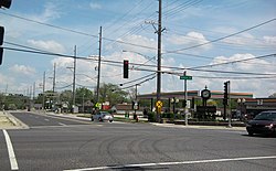
Thornton, Illinois
Appearance
Thornton, Illinois | |
|---|---|
 | |
 Location of Thornton in Cook County, Illinois. | |
 Location of Illinois in the United States | |
| Coordinates: 41°34′17″N 87°36′42″W / 41.57139°N 87.61167°W | |
| Country | United States |
| State | Illinois |
| County | Cook |
| Township | Thornton |
| Founded | 1834 |
| Incorporated | 1900 |
| Government | |
| • Type | Council-Trustee |
| • Body | Board of Trustees |
| Area | |
| • Total | 2.40 sq mi (6.22 km2) |
| • Land | 2.38 sq mi (6.15 km2) |
| • Water | 0.03 sq mi (0.07 km2) |
| Elevation | 620 ft (190 m) |
| Population | |
| • Total | 2,386 |
| • Density | 1,004.63/sq mi (387.96/km2) |
| Time zone | UTC-6 (CST) |
| • Summer (DST) | UTC-5 (CDT) |
| ZIP code | 60476 |
| Area code | 708 |
| FIPS code | 17-75185 |
| GNIS feature ID | 2399975[2] |
| Website | www |
Thornton is a village in Illinois in the United States.
References
[change | change source]- ↑ "2020 U.S. Gazetteer Files". United States Census Bureau. Retrieved March 15, 2022.
- ↑ 2.0 2.1 U.S. Geological Survey Geographic Names Information System: Thornton, Illinois
- ↑ "Thornton village, Illinois". United States Census Bureau. Retrieved September 24, 2023.

