
Cape May County, New Jersey
Cape May County | |
|---|---|
 Sunset on Sunset Beach in Lower Township in May 2009 | |
 Flag | |
 Location within the U.S. state of New Jersey | |
 New Jersey's location within the U.S. | |
| Coordinates: 39°05′N 74°52′W / 39.08°N 74.86°W | |
| Country | |
| State | |
| Founded | 1685 |
| Named for | Cornelius Jacobsen Mey |
| Seat | Cape May Court House |
| Largest municipality | Lower Township (population) Middle Township (area) |
| Area | |
| • Total | 620.31 sq mi (1,606.6 km2) |
| • Land | 251.52 sq mi (651.4 km2) |
| • Water | 368.79 sq mi (955.2 km2) 59.5% |
| Population | |
| • Total | 95,263 |
| • Density | 378.9/sq mi (146.3/km2) |
| Congressional district | 2nd |
| Website | capemaycountynj |
Cape May County is the southernmost county in the U.S. state of New Jersey. Its county seat is the Cape May Court House section of Middle Township.[3]
References
[change | change source]- ↑ "2020 U.S. Gazetteer Files". United States Census Bureau. Retrieved January 12, 2024.
- ↑ "QuickFacts: Cape May County, New Jersey". United States Census Bureau. Retrieved January 12, 2024.
- ↑ John P. Snyder (1969). The Story of New Jersey's Civil Boundaries: 1606-1968 (PDF). Trenton, New Jersey: Bureau of Geology and Topography.
Municipalities and communities of Cape May County, New Jersey, United States | ||
|---|---|---|
| Cities | 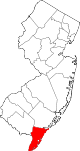 | |
| Boroughs | ||
| Townships | ||
| CDPs | ||
| Other communities | ||