Queens
Queens
Queens County, New York | |
|---|---|
 Location within New York City | |
| Coordinates: 40°45′N 73°52′W / 40.750°N 73.867°W | |
| Country | United States |
| State | New York |
| City | New York City |
| County | Queens County |
| Settled | 1683 |
| Named for | Catherine of Braganza |
| Government | |
| • Borough President | Donovan Richards (D) |
| • District Attorney (Queens County) | Melinda Katz (D) |
| Area | |
| • Total | 181.5 sq mi (470.0 km2) |
| • Land | 108.7 sq mi (281.6 km2) |
| • Water | 72.8 sq mi (188.4 km2) |
| Population (2020)[2] | |
| • Total | 2,405,464 |
| • Density | 22,120/sq mi (8,542/km2) |
| Demonym | Queensite[3] |
| Time zone | UTC−5 (EST) |
| • Summer (DST) | UTC−4 (EST) |
| ZIP Code format | 110xx, 111xx, 113xx, 114xx, 116xx |
| Area code(s) | 718, 347, 929, 917 |
| Website | Official Website of the Queens Borough President |
Queens is a borough of New York City and a county of New York State. It was named for Catherine of Braganza, the Queen of England and wife of King Charles II of England.

Queens is in western Long Island. The East River separates it from Manhattan in the east and The Bronx in the north. Queens' only land boundary with another New York City borough is with Brooklyn in the south and west. Jamaica Bay separates most of Queens from its Rockaway Peninsula in the south. Nassau County lies to the east. Until 1899, Nassau County was part of Queens County.
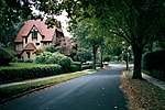
About 2.4 million people live in Queens and it is the largest borough of New York City in size and second in population (after Brooklyn). According to the United States census, Queens is the most ethnically diverse county in the USA. That means that it has the most people from different kinds of places, religions, and ethnic groups of any place in the USA. Large parts of Queens are urban and an equal part is suburban.
Transportation
[change | change source]Queens is home to both of New York City's airports, LaGuardia Airport (LGA) and John F. Kennedy International Airport (JFK). Queens is connected to the Bronx by three bridges: the Bronx Whitestone Bridge, the Throgs Neck Bridge and the Triborough Bridge. It is connected to Manhattan by two bridges and one tunnel: the Triborough Bridge, the Queensboro Bridge, and the Queens Midtown Tunnel.
Many controlled-access highways cross Queens, including I-495 (the Long Island Expressway), I-278 (the Brooklyn-Queens Expressway), and I-678 (the Van Wyck Expressway, pronounced Van Wike). Important state highways in Queens include the Grand Central Parkway, which becomes the Northern State Parkway when it crosses the Queens border into Nassau County.
Many New York City Subway lines go through Queens. The most famous is the Flushing Line, the 7 Train, which has the nickname "International Express" because it goes through many neighborhoods where many immigrants live. Other subway lines in Queens include the A Train, C Train, E Train, F Train, G Train, J Train, M Train, N Train, R Train, V Train, W Train, and Z Train.
Queens has a very large bus system that goes to all parts of the borough. Some bus routes go to Brooklyn, Manhattan, or the Bronx.
The Long Island Rail Road also has many stations in Queens. The Port Washington Line crosses northern Queens. There are busy stations at Woodside, Queens, Forest Hills, and Flushing. The central depot and main station for the railroad is in the neighborhood of Jamaica.
Sport & Recreation
[change | change source]
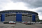
The New York Mets of the National League of Major League Baseball play in Citi Field in Queens. The U.S. Open, a famous and important tennis tournament, is played in Arthur Ashe Stadium in Flushing Meadows Park south of the baseball stadium.
Neighborhoods
[change | change source]
Queens has dozens of neighborhoods and named areas. These include:
- Addisleigh Park
- Arverne
- Astoria
- Auburndale
- Baisley Park
- Bay Terrace
- Bayside
- Bayswater
- Beechhurst
- Bellaire
- Belle Harbor
- Bellerose
- Blissville
- Breezy Point
- Briarwood
- Broad Channel
- Cambria Heights
- College Point
- Corona
- Ditmars / Steinway
- Douglaston
- Dutch Kills
- Edgemere
- Elmhurst
- Far Rockaway
- Floral Park
- Flushing
- Forest Hills Gardens
- Forest Hills
- Fresh Meadows
- Glen Oaks
- Glendale
- Hamilton Beach
- Hillcrest
- Hollis Hills
- Hollis
- Holliswood
- Howard Beach
- Howard Park
- Hunters Point
- Jackson Heights
- Jamaica
- Jamaica Estates
- Kew Gardens Hills
- Kew Gardens
- Laurelton
- Linden Hill
- Lindenwood
- Long Island City
- Little Neck
- Malba
- Maspeth
- Middle Village
- Morris Park
- Murray Hill
- Neponsit
- New Hyde Park
- Oakland Gardens
- Ozone Park
- Pomonok
- Queens Village
- Queensboro Hill
- Queensbridge
- Ravenswood
- Rego Park
- Richmond Hill
- Ridgewood
- Rochdale
- Rockaway Beach
- Rockaway Park
- Rockaway Point
- Rosedale
- Saint Albans
- Seaside
- South Jamaica
- South Ozone Park
- Springfield Gardens
- Sunnyside
- Utopia
- Whitestone
- Willets Point
- Woodhaven
- Woodside
References
[change | change source]- ↑ "2020 U.S. Gazetteer Files". United States Census Bureau. Retrieved September 11, 2023.
- ↑ ""P1: TOTAL POPULATION"". United States Census Bureau. Retrieved September 11, 2023.
- ↑ "What we learned: 2019 — New Yorkers are everywhere, like it or not". New York Daily News. December 31, 2019.
- ↑ "Borough of Manhattan, New York - Map and Latitude Longitude GPS Coordinates". Archived from the original on 13 January 2011. Retrieved 17 January 2011.
Other websites
[change | change source]![]() Media related to Queens, New York City at Wikimedia Commons
Media related to Queens, New York City at Wikimedia Commons
![]() Queens travel guide from Wikivoyage
Queens travel guide from Wikivoyage


